Graveyard of Empires Exterior and Hex Maps: Difference between revisions
Jump to navigation
Jump to search
No edit summary |
|||
| (2 intermediate revisions by the same user not shown) | |||
| Line 1: | Line 1: | ||
== World and City Maps == | == World and City Maps == | ||
<gallery> | <gallery> | ||
Meidia.jpg|Meidia Hemisphere Map | |||
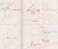
Curabel scan 03.png|Overview Map of Curabel | |||
Curmidden PV.png|Hexmap of Curmidden | |||
Midmark.png|Abstracted Map of Midmark | |||
Vargen Map.jpg|Vargen and Environs | |||
Xenkhel upper 2b.jpg|Xen'Khel Exterior | |||
GrotecopMap-Annotated.jpg|Underdark Map (Grotecop's, with Party Annotations) | |||
</gallery> | </gallery> | ||
== Maps of Small Locations == | == Maps of Small Locations == | ||
<gallery> | |||
Midmark Neighborhood Near Desric / Cock & Bull Inn | CockBull neighborhood.jpg|Midmark Neighborhood Near Desric / Cock & Bull Inn | ||
</gallery> | |||
== Maps | == Maps Augmented with Magical Information == | ||
<gallery> | |||
Curabel Overview with Orbital Scrying Mask Locations | Curabel scan 03 mask.png|Curabel Overview with Orbital Scrying Mask Locations | ||
Curabel Khel Map 2.png|Southern Curabel with Edan's Notations of Khel Locations | |||
Southern Curabel with Edan's Notations of Khel Locations | </gallery> | ||


